The Transcontinental Aqueduct. Leg 11: Cove Tank Reservoir to San Carlos Lake, a distance of 70 miles.

Stage 10 was a true pumped hydro-storage peak power stage, producing up to 11.5 GW electric power for up to 5 hours a day. In stage 11 the flow will be a maximum flow of up to 25,000 cfs, but with periods of less flow during low electricity demand, all to accommodate both water needs and power demands.

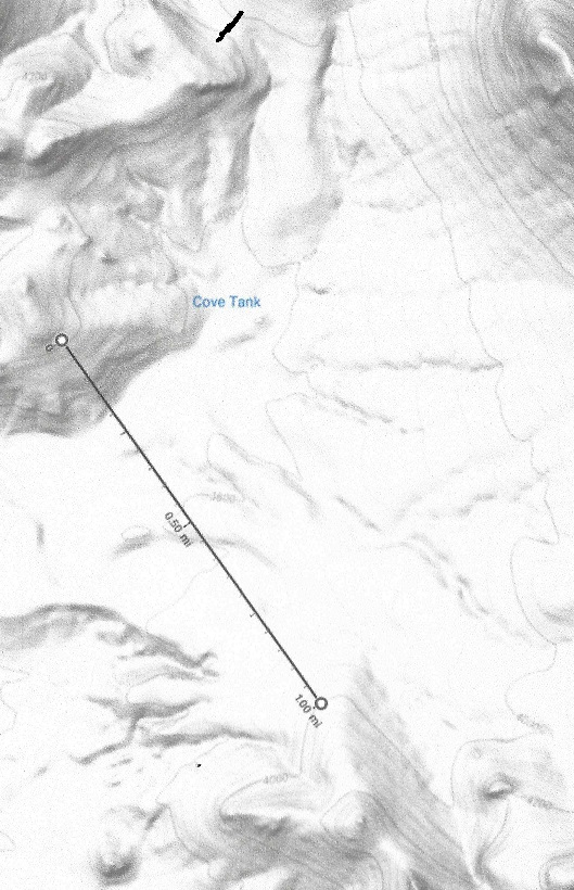
The Cove Tank Reservoir dam is 1 mile wide and 250 feet high, the top of the dam is at 4,000 feet. containing up to 60,000 acre-ft of water, enough storage for more than a day’s flow.

The Cove tank Reservoir starts out nearly empty when peak power demand starts, and is rapidly filling up until peak demand ends

The power generating drop is on average (3800 – 2535 – 70×2.2) = 1,111 feet. This stage is capable of generating maximum 2.2 GW of power during peak power demand, adjusted down at low power demand to not exceed the daily water supply.

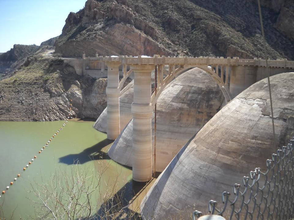
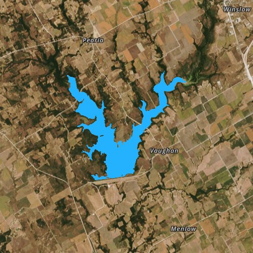
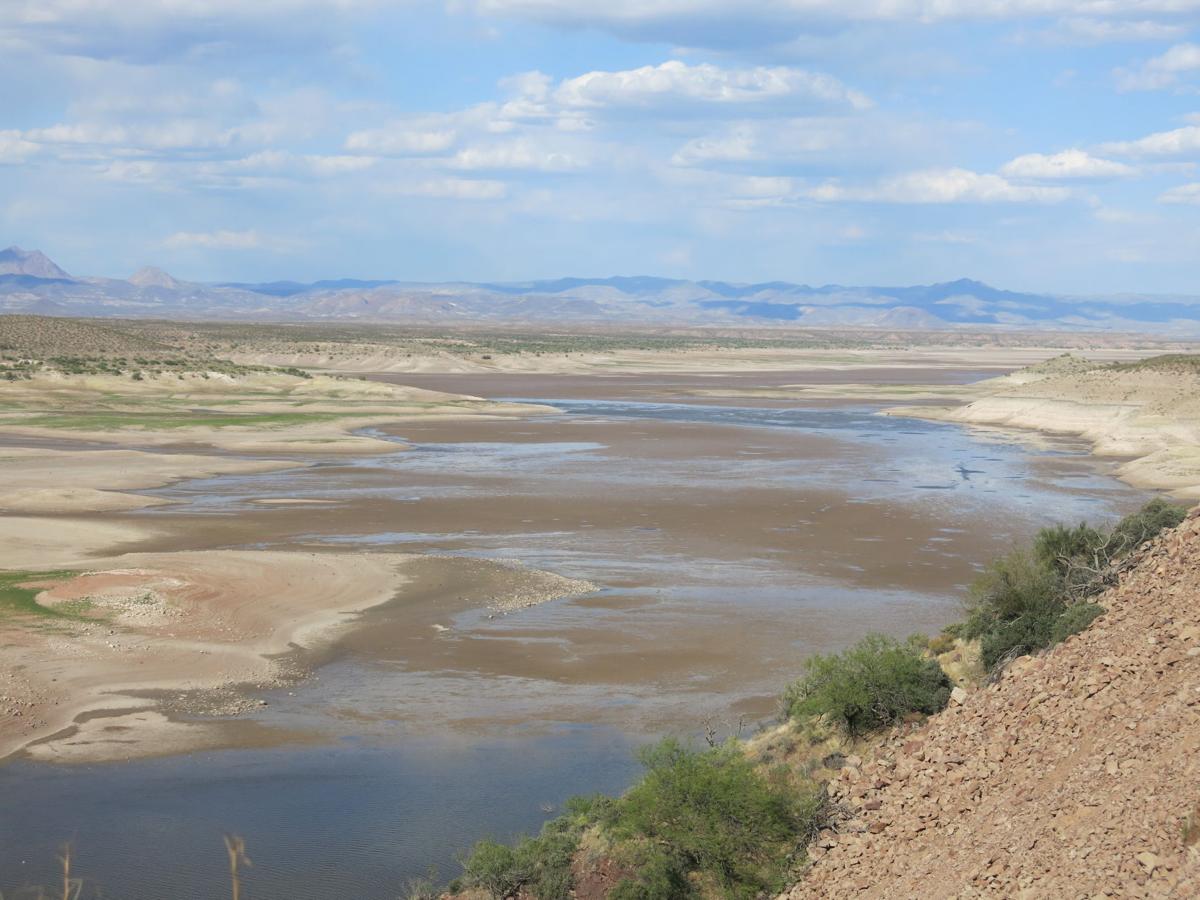
San Carlos lake is located within the 3,000-square-mile (7,800 km2) San Carlos Apache Indian Reservation, and is thus subject to tribal regulations. It has been full only three times, in 1993 it overflowed the spillway and about 35,000 cfs of water caused erosion damage to natural gas pipelines. The lake contains now (April 6,2021) less than 100 acre-ft of water. All fish is dead.

When former President Coolidge dedicated the dam in 1930, the dam had not begun to fill. Humorist Will Rogers looked at the grass in the lake bed, and said, “If this were my dam, I’d mow it.”[

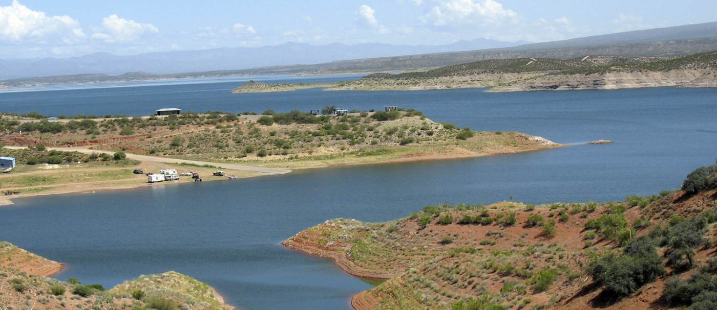
When the Transcontinental aqueduct is built the lake will always be nearly filled, with flood control nearly automatic, it will never overflow, and it will look like this:

The San Carlos lake, when filled will hold 1,000,000 acre-ft of water.

The Coolidge dam will have to be retrofitted for a 25,000 cfs water flow

The Transcontinental Aqueduct. Leg 8: Arch Lewis Canyon Lake to Martin Tank Lake, a distance of 50 miles.

Stage 8 ended in Arch Lewis Lake. It will be filled mostly during the 5 hours of peak power generation. During the other 19 hours the fill rate will be very low leading to lowering water levels.

It has a 3000 feet wide and up to 480 feet high dam, topping out at 4620 feet, and the lake holds a volume of up to 60,000 acre-ft of water.

From the Arch Lewis Lake dam to the Martin Tank Lake the distance is 60 miles the way the aqueduct takes. It will first descend to 3720 feet before rising to 5190 feet. The descending drop is (4620 – 3720 – 2.2 x 9), or up to 890 feet. The Martin Canyon Lake will top out at 5200 feet with maximum water level at 5190 feet. The total lift of the water in this stage is (5190 – 3720 + 51×2.2) feet = 1582 ft. To lift 25,000 cubic feet per second (1582 x 1.03 – 890 x 0.97) = 766 feet requires three 500 MW LFTR nuclear reactors plus the use of 80 MW from the grid. The Martin Tank Lake dam is 22260 feet wide and 230 feet high. It will contain about 30,000 Acre-ft when full, about eighteen hours worth of storage. For 5 hours per day the three reactors can provide 1.5 GW of peak power to the grid.

The Transcontinental Aqueduct. Leg 7: White Oaks Canyon Lake (to be made) to the Arch Lewis Canyon Lake via a 20 mile tunnel under the Guadaloupe Mountains in New Mexico.

Dam 1 dams the White Oaks Canyon Lake. It has a 2000 feet wide and up to 400 feet high dam, topping out at 5000 feet, and the lake holds a volume of up to 80,000 acre-ft of water.

Dam 2 dams the Last Chance Canyon Lake. It has a 2200 feet wide and up to 380 feet high dam, topping out at 5680 feet, and the lake holds a water volume of up to 35,000 acre-ft.

The Stage 7 is a tunnel, starting at 4600 feet and ending at 4492 feet maximum levels. The 20 mile long tunnel will drop 88 feet as it passes under the mountain.

Dam 3 dams the Upper Canyon Lake for lack of a better word. It has a 1600 feet wide and up to 240 feet high dam, topping out at 5200 feet, and the lake holds a volume of up to 15,000 acre-ft of water.

Dam 4 dams the Arch Lewis Canyon Lake for lack of a better word. It has a 3000 feet wide and up to 480 feet high dam, topping out at 4600 feet, and the lake holds a volume of up to 60,000 acre-ft of water.

Up to now all stages have pumped water up the mountains. This stage releases the hydroelectric water storage, and it does so even during peak power, so the water flows all 24 hours with peak electricity creation during peak usage. By now, the average flow is down to 19000 cfs , 24 hours a day. During off peak hours, 19000 cfs flows down the tunnel, the power generated is coming from Dam 1 with a water level of between 4980 feet and 4700 feet with an average of 4940 feet. The maximum output level of the water is 4640 feet, so a drop of 300 feet will generate a minimum of 450 MW of power, or 8.6 GWh/day. Part of this energy will be used to pump up the water to Dam 2 and 3. Dam 2 will pump 13,000 cfs of water from 4630 feet to between 5820 feet ans 5520 feet, (average 5760) for 19 hours, an average lift of 1,060 feet. This required a total of 6.2 GWh of energy per day , or 326 MW pf power. Dam 3 will pump 6,000 cfs of water from 4630 feet to between 5200 feet and 4930 feet, (average 5120) for 19 hours, an average lift of 520 feet. This required a total of 1.4 GWh of energy per day , or 74 MW pf power.

The net electricity generated during 19 off peak hours is 1.0 MW on average. The electricity generated during the 5 peak hours is 49,000 cfs at a drop of 1060 feet, or 1.16 GW, from dam 2. From dam 3 it will be 22,800 cfs at a drop of 520 feet, or 264 MW. From the 2 dams , total electricity is 1.42 GW. Total electricity generated during these 5 hours is 7.12 GWh. This assumes a 97% efficiency of the reversible pumps from Dam 2 and 3. The pumps from Dam 1 are not reversible.

The tunnel capacity between Dam 1 and Dam 2 outlets is 19,000 cfs, between Dam 2 and 3 it is 49,000 cfs, and from Dam 3 to its exit in Dam 4 it is 71,800 cfs.

The Transcontinental Aqueduct. Leg 1: Mississippi river to Aquilla lake.

The Transcontinental aqueduct at the starting point will have a carrying .capacity of 15 million acre-ft per year, or 21,000 cubic feet per second on average. Maximum flow will be 26,500 cfs, allowing the power generators to supply peak power to the grid for up to 5 hours per day instead of pumping water.

The starting point of the aqueduct is where the Red river empties out in the Atchafalaya river, and has a Mississippi River diversion dam. The elevation at the starting point is 7 feet, and the dam and pumping station will be located in the upper part of the never used Atchafalaya Floodway.

The Mississippi River flood control Morganza spillway is south of the Atchafalaya river diversion, and will not interfere. The place chosen is ideal to relieve some of the Mississippi river flow. Even in the lowest Mississippi flow in a drought year this diversion has sufficient flow to divert 26,500 cfs from it.

The first leg of the aqueduct is 360 miles long and is an open water river with pumping stations whenever the river has to rise about 30 feet. The river runs by gravity until it has sunk about 15 feet which is about 6.18 miles downstream. Since endpoint is at 537 feet elevation this requires about 58 pumping stations. During the course of the path the aqueduct crosses the Sabine River south of the Toledo Bend Reservoir, following the best climb it crosses the Neches River and the Trinity River following the geologically best way until it reaches the Aquilla Lake. The aqueduct is quite substantial, it will carry about 80% more water than the All American canal, seen here under construction. This canal has a drop of about 2.2 feet per mile to accommodate maximum flow.

Pumping 26,500 cfs water through 58 pumping station, each one raising the water about 30 feet requires 4 Gigawatts of power when rounding up for turbine losses. This can be accomplished by eight 500 MW LFTR reactors, also being able to provide up to 4 GW of peak power for 5 hours/day on demand. Two will serve the eastern power grid and six will serve the Texas electrical grid.

The end point for stage 1 of the channel is Aquilla lake, elevation 537 feet. It has a storage capacity of 50,000 acre-ft, which is only half a day’s worth of storage, so Stage 1 and Stage 2 will have to be managed as a unit. It is located 20 miles North of Waco, TX.