Leg 2 of The Trans-Rocky-Mountain aqueduct. From Webbers Falls to Keystone Dam.

The second leg of the Trans-Rocky-Mountain aqueduct start from Webbers Falls

Elevation 491′

to Keystone Dam, a distance of about 75 miles that is not canal and 25 miles, which is

Elevation 771′ streambed 550′ 2 turbines totaling 70 MW. Normal water level 727′

There is still barge traffic upstream from Webbers falls, so the water level is still controlled by the canal traffic controllers. This means that the volume of water pumped upstream must be subject to the same limitations that was valid for leg 1.

The Arkansas river flows through Tulsa, and in 2019 there was a substantial flood when the release from the Keystone dam peaked out at 310,000cfs after it had rained 22 feet in a short time. On the other hand, there are days with no release at all when the evaporation from the Keystone lake is larger than its inflow. The river flows right through Tulsa with beautiful park trails on top of the banks, and must be preserved and improved.

The proposal is this: Build 4 30′ dams with full opening gates so up to 250,000 cfs can be released. There will be a power house in each, containing two 5,600 cfs pumps/generators. Through Tulsa build three 10′ dams with the same capacity as the four lower dams. Lower the river bed all over by at least six feet to lessen the occurrence of floods. Since the barge canal separates from the Arkansas River before the first new dam on the Arkansas River there is now more liberty to adjust the pumping to meet the electricity needs and momentarily shut off the pumping when energy needs spike.

The water level above the Keystone dam will be kept at conservation pool level of 727′. If heavy rains are anticipated the water level will be allowed to go below conservation pool level. Conversely, when drought periods are expected, the water level is increased in anticipation. This will make the lake more desirable for recreational purposes to have a stable water level at all times, increasing and decreasing much less over time and with only a moderate daily fluctuation.

The Keystone dam power station generating plant will be retrofitted with dual generator/pumps or pumps will be added to be able to lift 11,200 cfs of water into the dam.

The average flow in the river, excluding flood condition is approximately 4,000 cfs. The pump capacity is 11,200 cfs, the total lift is 236 feet, the level drop is assumed to be 0.4 feet/mile for the 75 miles of aqueduct/river, and a pump efficiency of 92% is assumed.

The total power requirement using these parameters would then be 267 MW. When flow is reversed, it can provide up to 218 MW of peak power. There will be 267 MW of LFTR nuclear power available when it is not pumping up water, so for a short time every day it can provide 485 MW of peak power. The loss of power from the Keystone dam current average release will be about 50 MW on average.

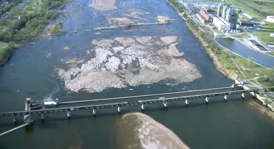
Below is a picture of the Arkansas River with sandbanks. It will have a number of small lakes with about 10 feet of water depth, mostly flowing up river, but gently flowing down river during peak power demand.

Leg 1 of The Trans-Rocky-Mountain aqueduct. From the Mississippi river to Webbers Falls lock and dam.

The Trans-Rocky-Mountain aqueduct starts out at the Mississippi river, and for the first leg follows the Arkansas River from Mississippi River to Lock16 of the Arkansas River, a distance of 366 miles.

Location of the locks and pumping stations on the Arkansas river.

Lock 1, entrance from the Mississippi River to the White river. The water surface at Montgomery Point has fluctuated from elevation 104′ to 172′.

This lock was added later to better accommodate barge traffic when the Mississippi River was running abnormally low. If the Mississippi is normal to high level, this lock is bypassed. Since we are going to move 11,200 cfs of water over the rocky mountain the flow amount in Arkansas river will be reduced by the same amount. In times of drought, the Arkansas River flow is sometimes lower than 11,200 cfs. To alleviate that, a series of 7,500 cfs pumps will be installed, one in every lock of the canal, beginning with Lock 3.

Montgomery Point Lock and Dam features “first of its kind” hydraulically operated gates. When the tail water is at elevation 115′ and rising, the dam gates are flat on the bottom of the river and barge traffic passes over the gates in the navigation pass spillway to minimize lockages saving time and money.
This lock is frequently submerged. Only the top of the control tower remains above water

The Mississippi river is muddy. When water is pumped up there needs to be a number of de-silting pools, where the silt is returned to the Mississippi river. Here is suggested 3 pools, each capable of de-silting 10,000 cfs of water, one for the Trans-Rocky Mountain aqueduct, and two for the Trans-Continental aqueduct, being built as the whole aqueduct is nearing completion. The top of the pools is set at 150 ft elevation. Should the Missisippi River flood higher than 142 feet the operation will be shut down until elevation is below 142 feet again, and Lock 2, the Norrell Lock and dam is operational again. For the Trans-Rocky_Mountain aqueduct up to 10,000 cfs needs to be pumped up between 20 and 62 feet, for an energy consumption of between 1MW and 56 MW. The map below show one possible location for the pools:

The de-silting pools.
Elevation 142′ No change
Elevation 162′ No change

Elevation 182′
Elevation 1196′
Elevation 213′
Elevation 231′
Elevation 249
Elevation 265′
Elevation 284′
Elevation 336′
Elevation 370′
Elevation 391′
Elevation 412′
Elevation 458′
Elevation 487′

From Lock # 3 to lock # 16 (13 locks # 11 is missing) the Power houses have to either replace one of the operating turbines to a corresponding dual function pump/generator, or add a 10,000 cfs pump.

By removing 11,200 cfs from the flow of water in the Arkansas river, it will be necessary to add these pumps to ensure functioning locks even in times of extreme droughts. The total power generated by the power stations will be reduced by 11,200 cfs times (487 – 127) feet * 0.9 or about 370 megawatts total.

As a side note, every lock opening uses up water equivalent of between 22 and 66 kWh depending on the size of the lift or lowering of the barges. This is constant and not dependent on the size of the barges or boats. When the spillways are in use, the water is “free”, but otherwise every lock opening costs a few dollars in energy, not much, but in case of a drought the fact that water is pumped back up the river will help increase the capacity.

What is in it for Arkansas? The added pumps will give an additional tool to control the canal system. In addition, in the case of floods it will somewhat alleviate the flood control, and serve the canal system better in times of drought. To add 400 megawatts to the system, may I suggest 2 200 MW LFTR nuclear reactors, they are carbon neutral. In addition they have the ability to shut off the pumping of water and let the power plants provide 400 MW virtual hydro-storage power for up to five hours/day. The barges will benefit from sometimes go with the flow, and sometimes travel over still water, shortening the time of transport substantially.