The Transcontinental aqueduct Leg 12: From the East Diversion dam to connecting to the Central Arizona aqueduct 45 miles WNW of Phoenix.

Leg 12 of the Transcontinental aqueduct is complicated. The total length of this segment is 105 miles, 20 miles is a 6,200 cfs aqueduct, and 85 miles is the Gila River. This map may help explain it:

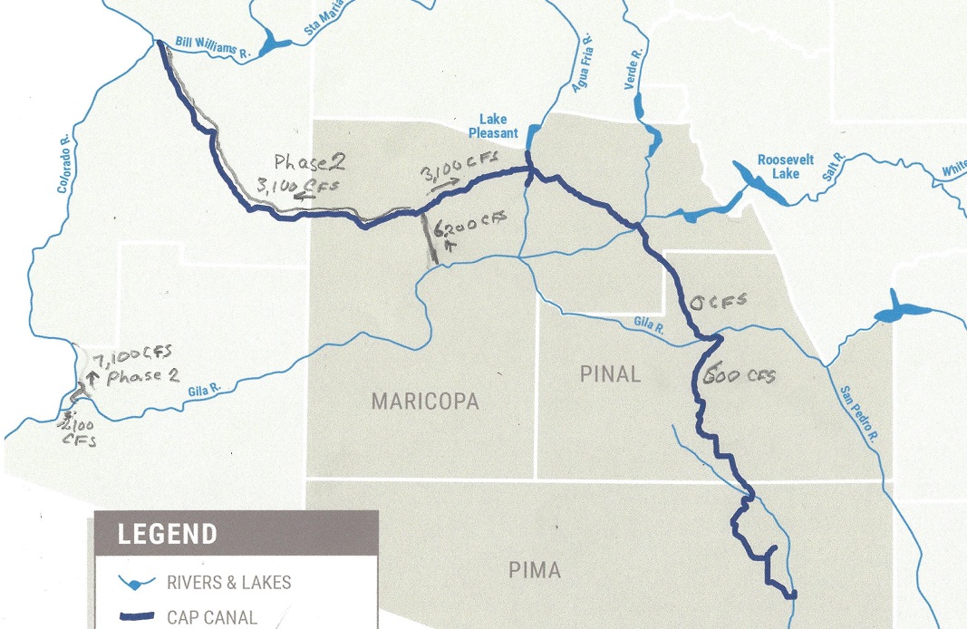
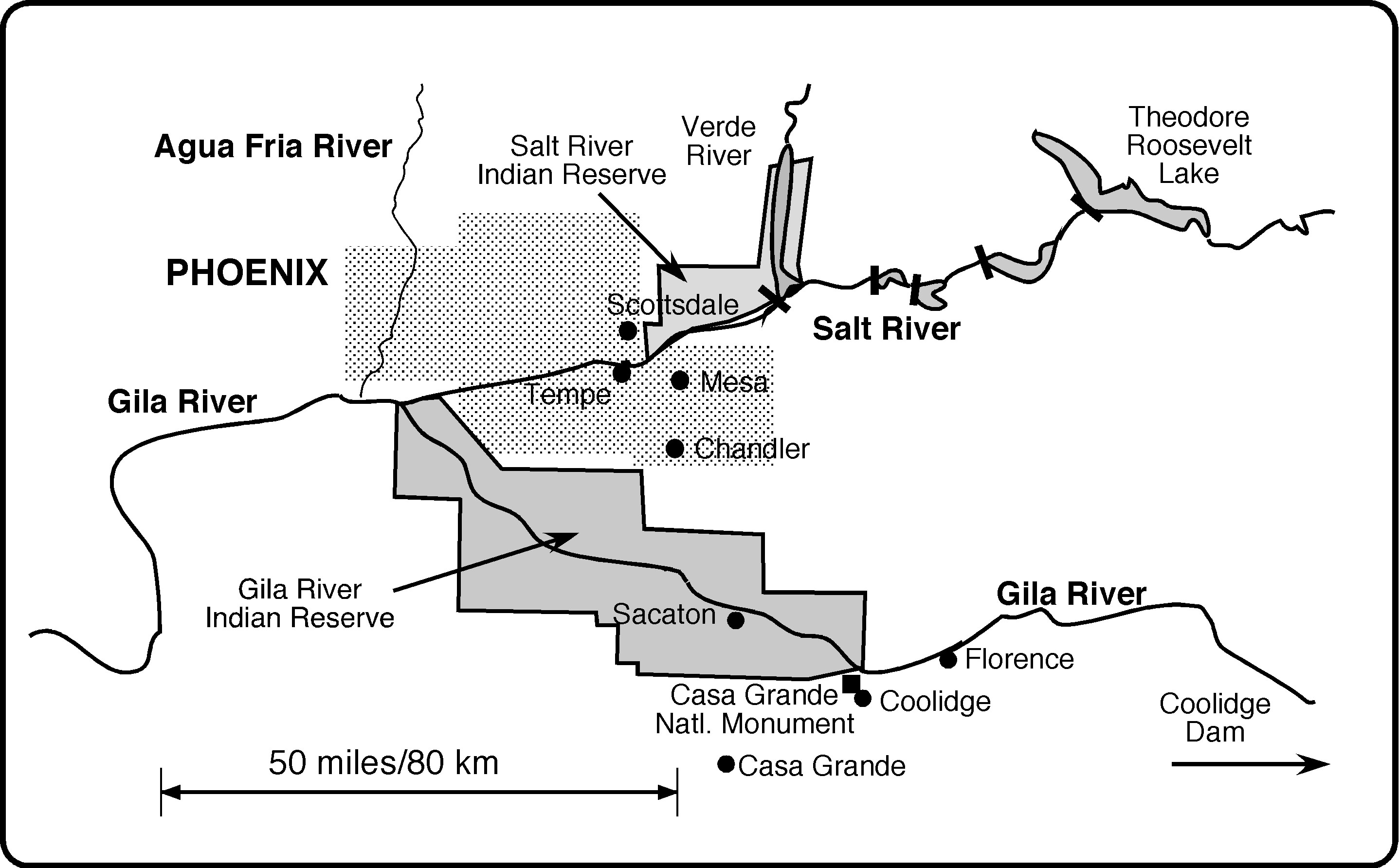
But there is a problem that must be solved. Gila River is now mostly dry, and goes through an Indian reservation. The Gila River used to provide about 1.3 Million Acre-ft per year, snow-melt and monsoon rains providing nearly all of it, but was seasonally dry. Now all the water and then some is spoken for, so the Indians get nothing, and without water you can do no farming, so the reserve is largely depopulated. See map:

The home of the Gila River Indian Community The Salt and Gila Rivers flow east to west. Present day dams that divert the Salt River into a series of canals are indicated. Roosevelt Dam was completed in 1911, creating Theodore Roosevelt Lake, and Coolidge Dam was completed in 1930. Important locations include the Casa Grande structure, an artifact of the Hohokam times, and the city of Florence, site of the Florence Canal, which is described in the text. The Gila Indians today live on the Reserve shown, with headquarters at Sacaton. The related Salt River Pima-Maricopa Indians live on a separate reserve on the Salt.

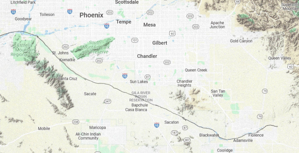
In Phase 1, the Gila River will free flow. In Phase 2 there will be a55 mile aqueduct thru the Indian reserve dimensioned for 10,000 cfs flow. It will provide some power with a drop of over 400 feet. The maps will look like this:

Leg 12 east starts out at 1580′ and ends at Arlington Dam, 795′
Leg 12 west starts at Arlington dam, 705′ and ends at the CAP canal at 1,380′

Total power required for Leg 12 is 160 MW for phase 1 and 320 MW for Phase 2. Since it is continuous it is best served by three 100 MW LFTR reactors.

In Phase 2 the CAP aqueduct will be replaced by one that flows from east to west, and the Mark Wilmer pumping station will be converted to the Mark Wilmer generating station with the same capacity. Electricity generated will be 16% less than the energy that used to be consumed to pump up the water.

Mark Wilmer PP Aerial March 29, 2012 Central Arizona Project photo by Philip A. Fortnam

What is in it for Arizona? The Greater Phoenix area will get an increased water supply from the canal,since Tucson is already served in Leg 11. The Gila Indian reserve will get back the water supply that was taken away from them, a way of reparation, and will again make the Gila Indian reserve a viable community.

Published by

lenbilen

Retired engineer, graduated from Chalmers Technical University a long time ago with a degree in Technical Physics. Career in Aerospace, Analytical Chemistry, computer chip manufacturing and finally adjunct faculty at Pennsylvania State University, taught just one course in Computer Engineering, the Capstone Course.

Leave a Reply

Fill in your details below or click an icon to log in:

WordPress.com Logo

You are commenting using your WordPress.com account. Log Out /  Change )

Facebook photo

You are commenting using your Facebook account. Log Out /  Change )

Connecting to %s

This site uses Akismet to reduce spam. Learn how your comment data is processed.